Attraction
Sixth Principal Meridian – Mahaska
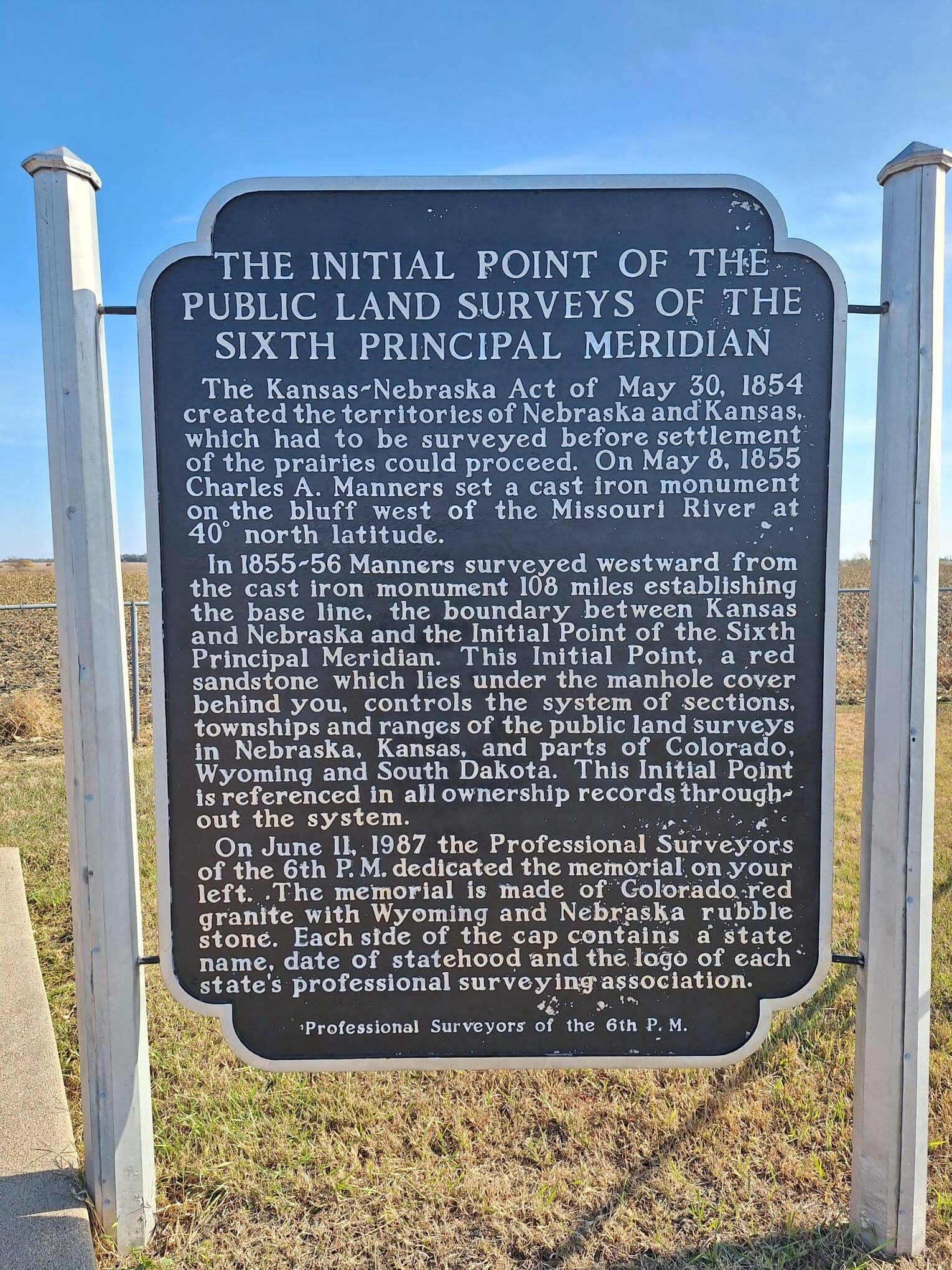
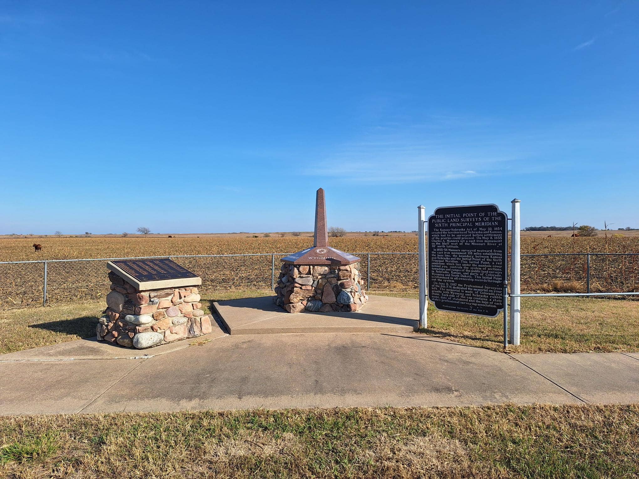
Located near the town of Mahaska, Kansas, the 6th Principal Meridian Marker marks one of the most significant points in the geographic history of the United States. This survey point serves as the “starting line” for the legal land descriptions of over 200 million acres across five states.
Historical Significance
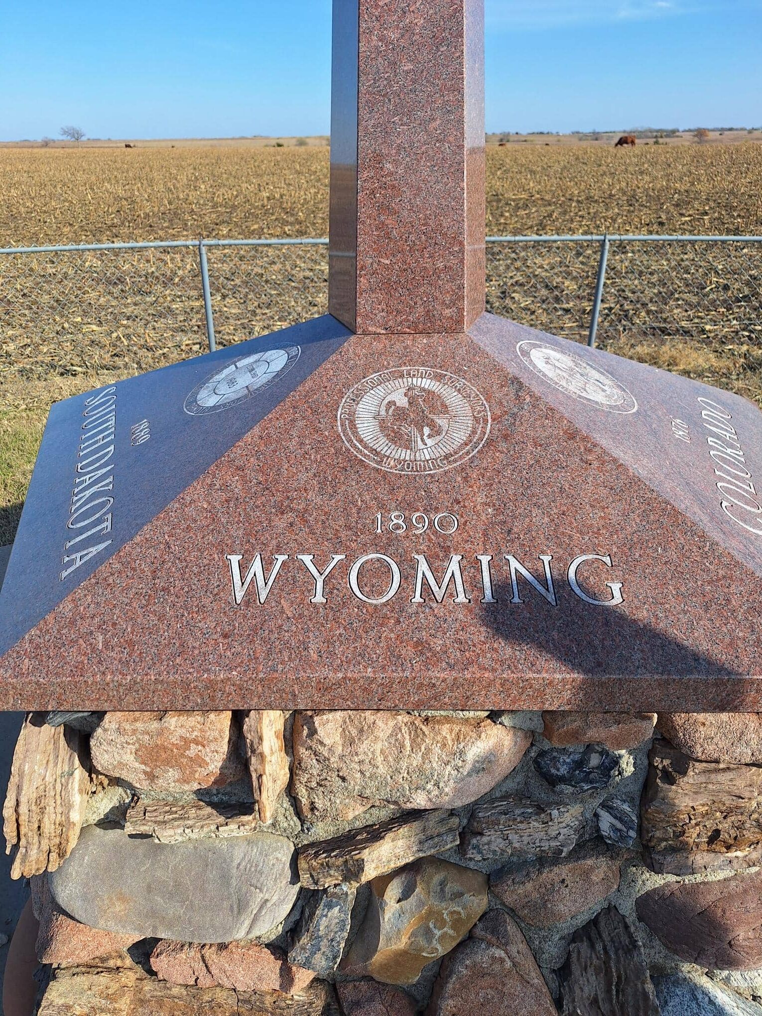
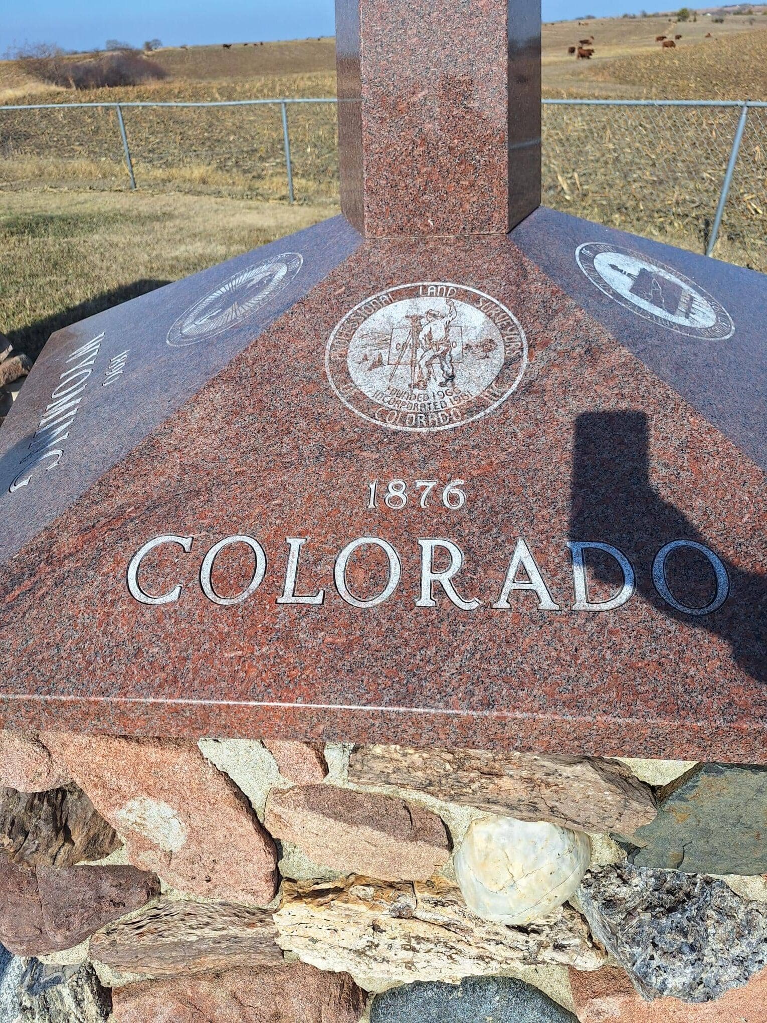
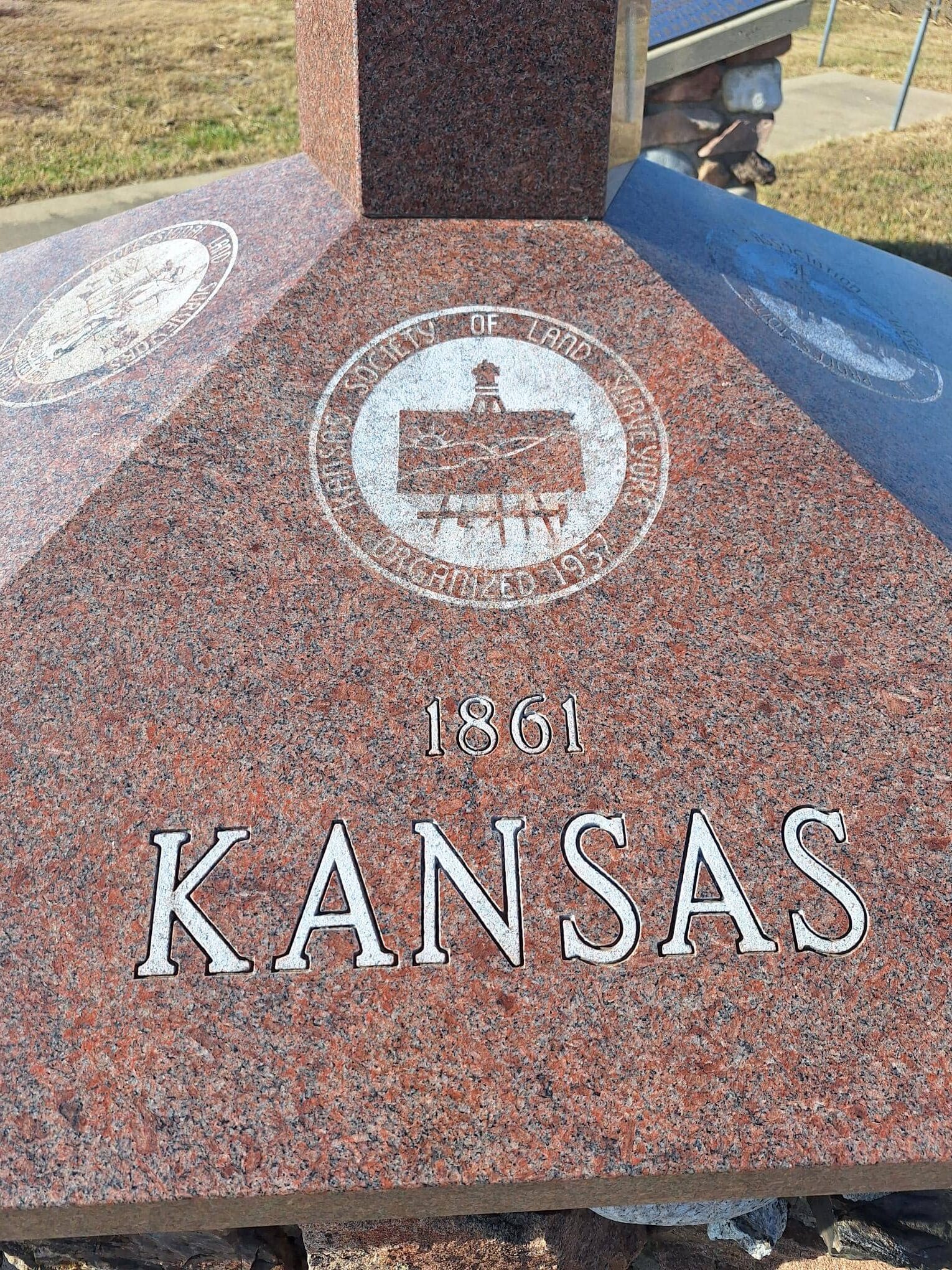
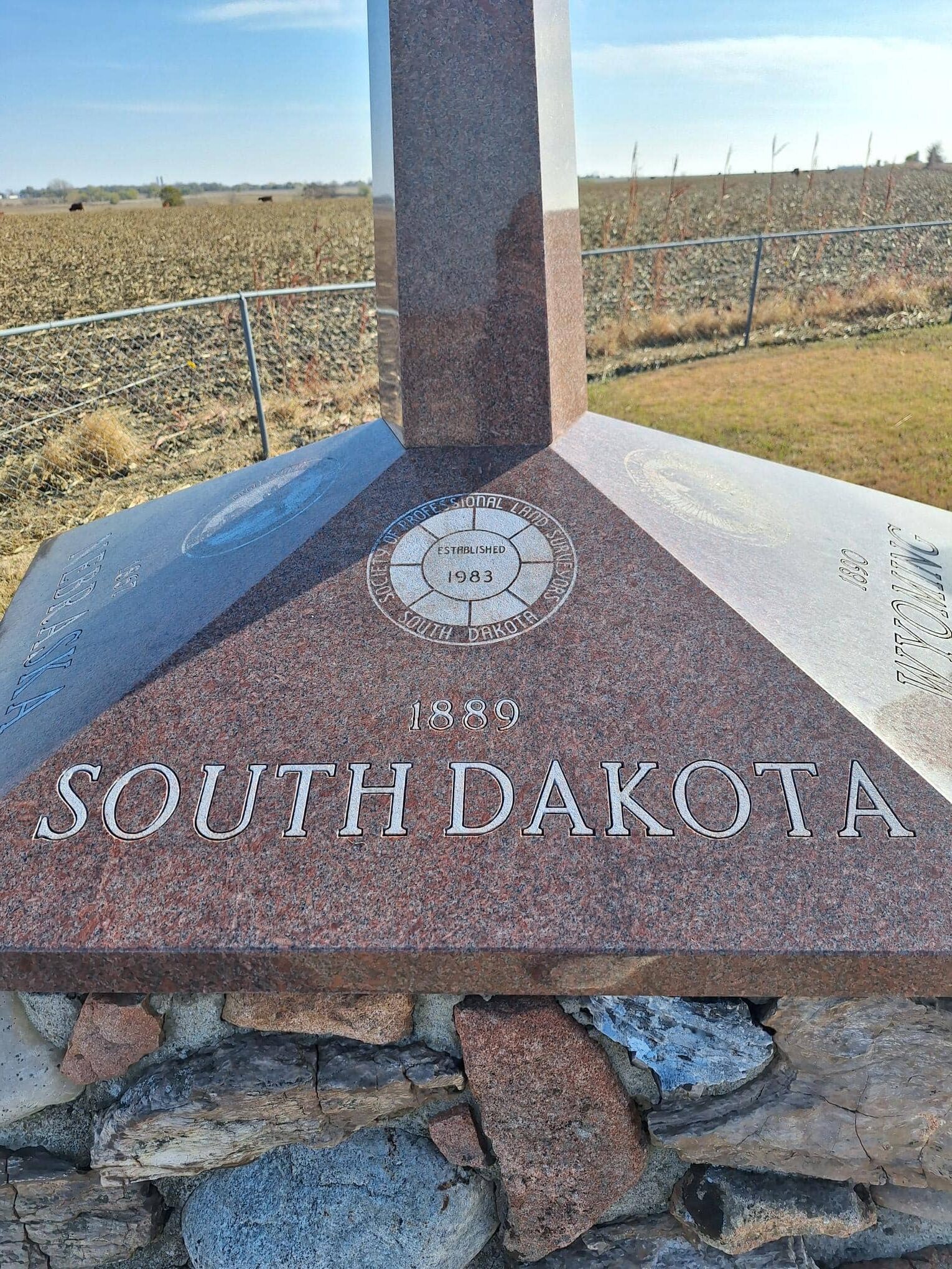
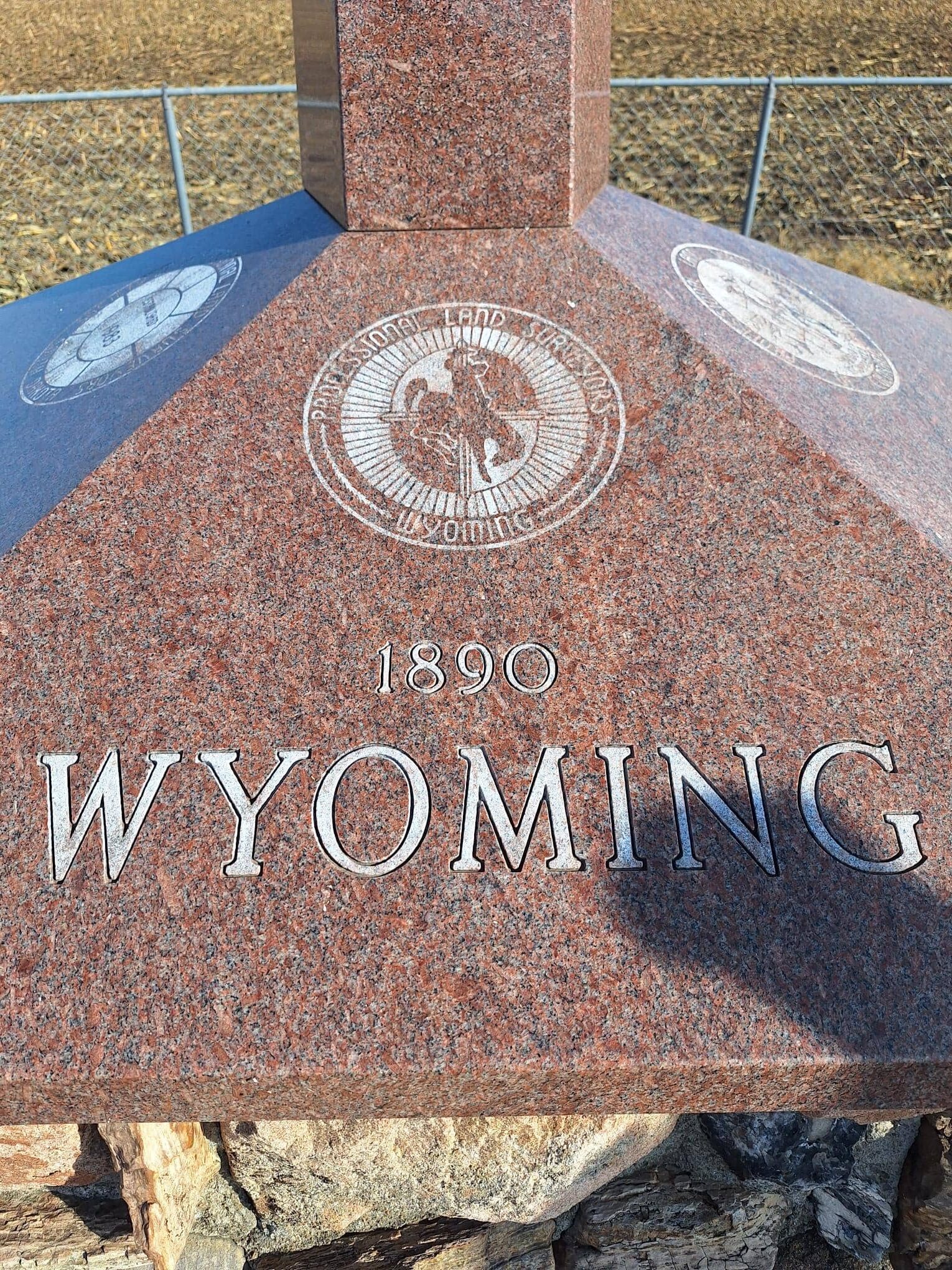
Established in 1855, the 6th Principal Meridian was the baseline for the land surveys of Kansas, Nebraska, and portions of Colorado, Wyoming, and South Dakota.
- The Intersection: The marker is placed at the intersection of the 40th parallel (the Kansas-Nebraska border) and the 6th Principal Meridian.
- The Homestead Act: Every farm, townsite, and ranch in these regions is legally defined by its distance from this specific point. It was the essential foundation for the orderly settlement of the Great Plains following the Kansas-Nebraska Act.
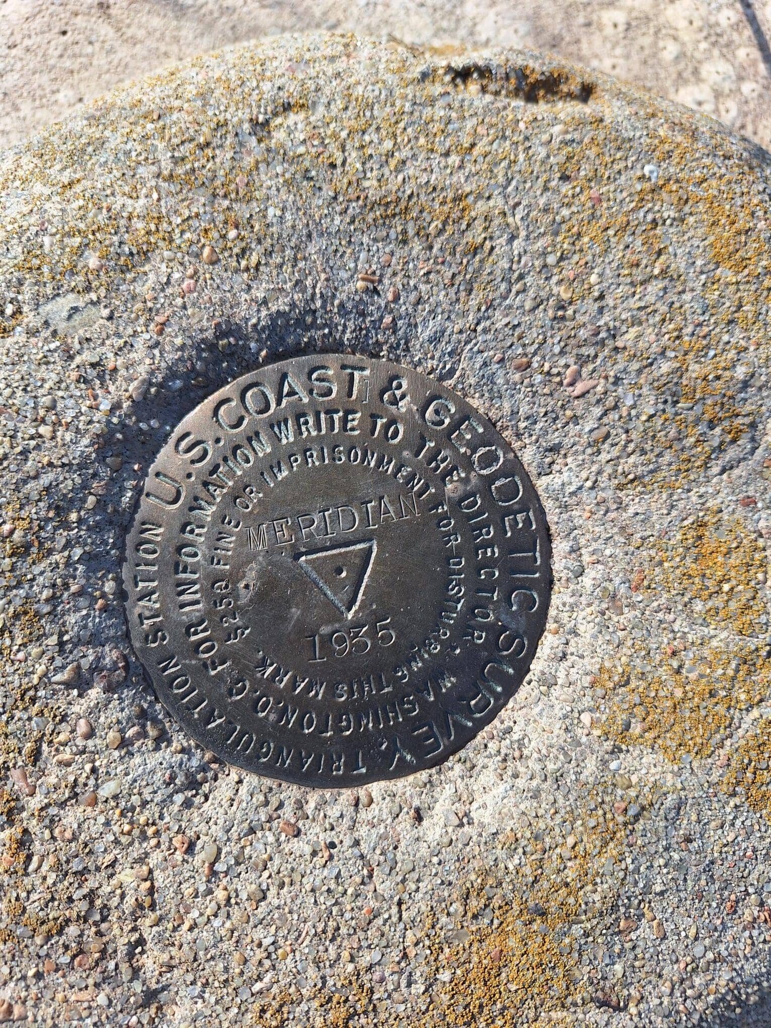
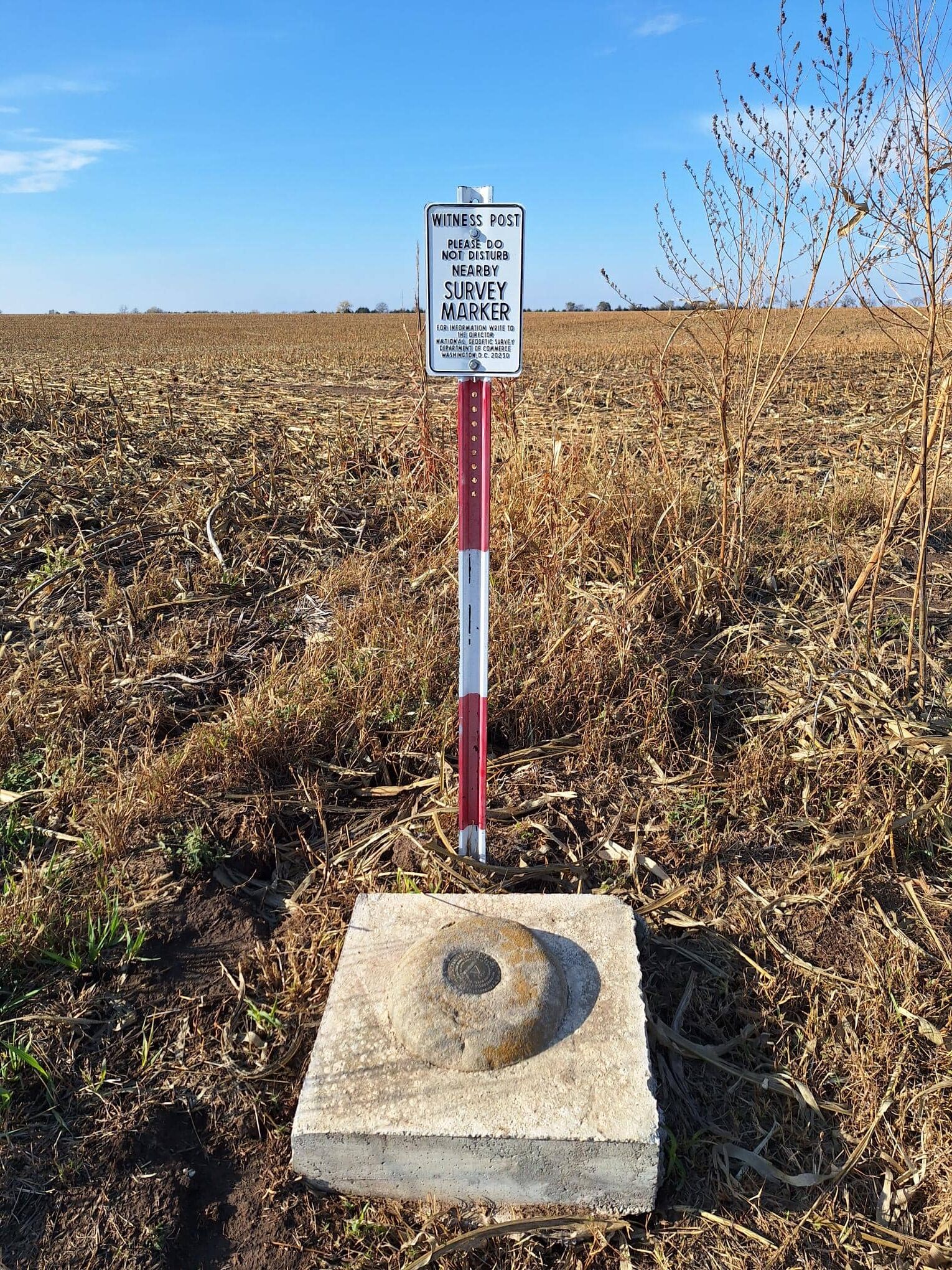
The Monument
In 1987, a dedicated monument was erected at the site to commemorate the surveyors who braved the frontier to map the West.
- Design: The monument features a large stone base with a commemorative plaque. At the heart of the site is the official survey cap set into the ground, marking the precise geographical coordinates.
- Flagpole and Plaza: The site includes a flagpole and a small plaza area, often used by surveyors and history enthusiasts as a pilgrimage site.
Share